Clearing and Grubbing in Dover, TN
Stumps, root plates and the organic mat taken out to competent subgrade on Stewart County ground, with the exposed soil stabilised behind the machine.
Get a Free Land Clearing Quote in Clarksville
Tell us the acreage, the road it fronts and what the ground has to do afterwards. Form requests are answered the same working day, and every quote follows a site walk.
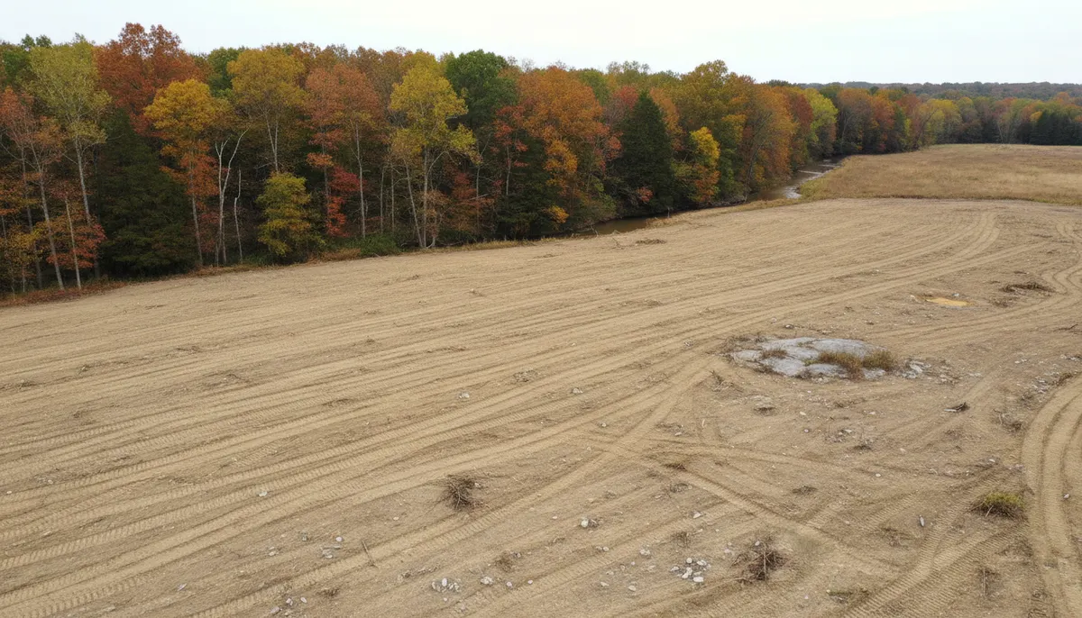
Dover is the seat of Stewart County, 1,826 people across 3.9 square miles at an elevation of 413 feet on the south bank of the Cumberland River, and the 2020 census recorded it as 100.0 percent rural, with no urban area inside the town at all. A county seat that is entirely rural is a place where clearing work is measured against pasture, footings and gravel rather than against a subdivision plat, and where the thing that decides a price is usually what the river left in the ground rather than what is standing on it.
Clarksville Elite Land Clearing runs clearing and grubbing on this ground, which means the stumps and the root plates and the mat of fine roots and organic soil under them come out rather than get reduced in place. That is the distinction that matters under a slab, a pavement section or a septic field, because organics left in the ground decay, lose volume and take the surface with them. Where nothing is going to bear load, a mulching pass is the cheaper and honest answer, and where the excavation continues past the root zone into cut and fill the scope becomes clearing with excavation attached.
What Grubbing Runs Into on Dover Ground
Three conditions shape a grubbing job here: the water, the rock and the wet-season calendar.
Water on three sides of the work
Dover sits on the Cumberland, Cross Creeks National Wildlife Refuge covers 8,862 acres along the river nearby, and Land Between the Lakes begins about six miles away. Water that close changes what grubbing is allowed to do. Under the Tennessee construction general permit a 30-foot natural riparian buffer is to be preserved between a waterbody and the disturbed area to the maximum extent practicable, and the minimum acceptable width is more than 15 feet at any measured location. Beyond that, excavation, bank sloping and stabilisation, channel work, filling or draining a wetland and road and utility crossings all trigger a TDEC Aquatic Resource Alteration Permit. Grubbing near a wet-weather ditch is exactly the operation that runs into this without meaning to.
Limestone in the root zone
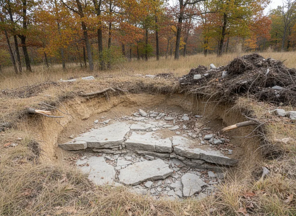
This is Western Highland Rim country, which the USGS calls the most dissected of the three subdivisions of the Highland Rim, underlain by the Ste. Genevieve, St. Louis and Warsaw Limestones and the Fort Payne Formation, with karst features developed through them. Grubbing is the clearing operation most exposed to that geology because it is the one that goes deepest. A root plate sitting on ledge comes out differently from one in soil, and a void under a stump is found by a bucket rather than from the seat. We walk a site before pricing rather than assuming uniform digging across an acre.
The dry window is short and it matters
Annual precipitation in this part of Tennessee runs near 51 inches, spread through the year with a hard spring peak: March, April and May total 14.60 inches with May the wettest month at 5.72 inches, while August at 2.95 and September at 3.49 are the driest. Grubbing moves more soil than any other clearing scope and it does it with heavy machines, so ground condition is not a detail. Late summer into early autumn is the clean window for dozer and grubbing work on ground that perches water above a fragipan, and spring work means tracked, low-ground-pressure equipment and a slower rate.
Clearing and Grubbing Permits in Dover, TN
Dover is in Stewart County, not Montgomery County, and the county numbers a Clarksville contractor carries in his head do not travel here. Below is what applies statewide, stated as fact, and what is local, stated as a step we confirm. Checked 30 July 2026.
The state permit applies the same in every Tennessee county
Tennessee's construction stormwater general permit, number TNR100000, covers clearing, grading or excavation resulting in an area of disturbance of one or more acres, and also smaller areas that form part of a larger common plan of development. Coverage is requested on notice of intent form CN-0940, and the complete application should be submitted at least 30 days before construction activities start. A site-specific stormwater pollution prevention plan is developed and submitted with that notice. Initial fees run from $250 for 1 to 5 acres to $1,000 for 5 to 20 acres. None of that varies because the parcel is in Stewart County rather than somewhere else.
The county layer, which we confirm rather than guess
Local government in Tennessee sits on top of the state permit, and Stewart County administers its own local requirements for grading, land disturbance and building through its own offices. We do not publish a Stewart County threshold or fee here, because we have not verified one for this page, and quoting a Montgomery County figure on a Dover parcel would be worse than saying nothing. What we do is confirm the local position with the county before a machine is booked, and tell you what it turns out to be. Dover is incorporated, so a parcel inside the town limits can carry a town step as well as a county one.
Locates, burning and what happens after the machine leaves
Tennessee 811 notice is at least three working days under Tennessee Code 65-31-101, with a 24-inch tolerance zone on each side of a marked facility and a ticket valid 15 calendar days. Debris burning needs a Tennessee Division of Forestry permit from 15 October to 15 May, taken out on the day of the burn, with a firebreak of at least 3 feet through leaves or short grass and 5 feet through tall grass or brush. Construction and demolition debris and most vegetation not grown on site cannot be burned at all. Once the machine stops, stabilisation is due within two weeks of activity ceasing on that part of the site, and within one week on steep slopes.
Sources for the requirements above:
- TDEC construction stormwater permit TNR100000, for the trigger, the notice of intent and fees (https://www.tn.gov/environment/permit-permits/water-permits1/npdes-permits1/npdes-stormwater-permitting-program/npdes-stormwater-construction-permit.html)
- The 2021 Tennessee CGP itself, for the buffer widths and stabilisation deadlines (https://tnepsc.org/2021_CGPpdfs/Permit.pdf)
- TDEC Aquatic Resource Alteration Permit, for the activities that trigger it (https://www.tn.gov/environment/permits/water/aquatic-resource-alteration-permit--arap-.html)
- Tennessee 811 law, for the notice period and ticket validity (https://www.tenn811.com/law)
- Tennessee Division of Forestry burn permits and TDEC open burning rules (https://www.tn.gov/environment/air/open-burning.html)
Where We Work Around Dover
The town itself is small, 3.9 square miles inside the 37058 ZIP, and most of the work we are asked for sits outside it on Stewart County ground reached from US 79. That corridor runs east toward Montgomery County and west toward the lakes, and it is the road that decides how far a machine and a float can travel in a morning.
Fort Donelson National Battlefield sits on the north edge of town above the river, and federal ground of that kind is a useful reference point for a landowner because it fixes where the protected river frontage is. Cross Creeks National Wildlife Refuge occupies 8,862 acres of bottomland nearby, and Land Between the Lakes begins about six miles out. The practical effect is that a large share of the private parcels around Dover have a boundary against public land or against water, and both of those change what a grubbing scope can do at the edges. We walk the boundary before pricing rather than working off a parcel map.
Away from the river the ground is rolling and wooded, parcels are large, and access runs over field entrances and private lanes rather than paved drives. Crossing a wet-weather ditch to reach the back of a property is a real permitting question here rather than a formality, and it usually decides where the work starts. Where a parcel only needs the standing material knocked back rather than the roots taken out, brush clearing is the cheaper scope and we say so. East on US 79 the county line puts you into Montgomery County, and work over that side is covered under stump grinding around Woodlawn.
Land Clearing Services Available in Dover
Four scopes that come up most on Stewart County parcels.
Clearing and Grubbing
Stems, stumps, root plates and organic mat removed to competent subgrade, with the spoil either buried off the building area by agreement or hauled.
Erosion Control
Silt fence, check dams, inlet protection and stabilisation inside the deadlines the state permit sets, which is two weeks, or one week on a slope.
Land Clearing and Excavation
Where grubbing runs on into cut, fill and a finished subgrade, one crew and one machine set does both rather than handing the site over halfway.
Debris Removal
Grubbing produces root balls and soil-laden wood, the worst material to burn and the heaviest to haul. Chipping, burial or haul-off is decided before the work starts.
How We Work in Dover
-
Walk the parcel to the water
Boundaries, wet-weather ditches, the buffer line and the ground condition at the low end, because on Dover parcels the constraint is almost always at the water.
-
Settle state and county before a date
The state permit position on acreage, plus the Stewart County step confirmed rather than assumed, and the 811 ticket placed with three working days notice.
-
Grub, then stabilise on the clock
Roots out to competent subgrade, spoil handled by the agreed method, and stabilisation done inside two weeks of work stopping rather than at the end of the job.
Nearby Communities We Serve
Storm damage cleanup in Cumberland City is the other Stewart County town, upriver under the stacks of the fossil plant, on the same county permitting footing.
Stump grinding around Woodlawn is the first stretch of Montgomery County east on US 79, where the county fee schedule and stormwater resolution take over.
Land clearing for farming at Erin covers the Houston County pasture ground south of here, a third county with its own local step.
Selective clearing at Palmyra is the Cumberland River frontage further upstream on SR 149, back inside Montgomery County.
Book a Site Walk on Your Acreage
Send the parcel details and we will walk the ground, measure the disturbed area, check the stormwater threshold and put a written scope in front of you before any machine is booked.