Selective Clearing in Palmyra, TN
Understory, scrub and selected stems taken out while the mature canopy stays standing, on Cumberland River ground along SR 149.
Get a Free Land Clearing Quote in Clarksville
Tell us the acreage, the road it fronts and what the ground has to do afterwards. Form requests are answered the same working day, and every quote follows a site walk.
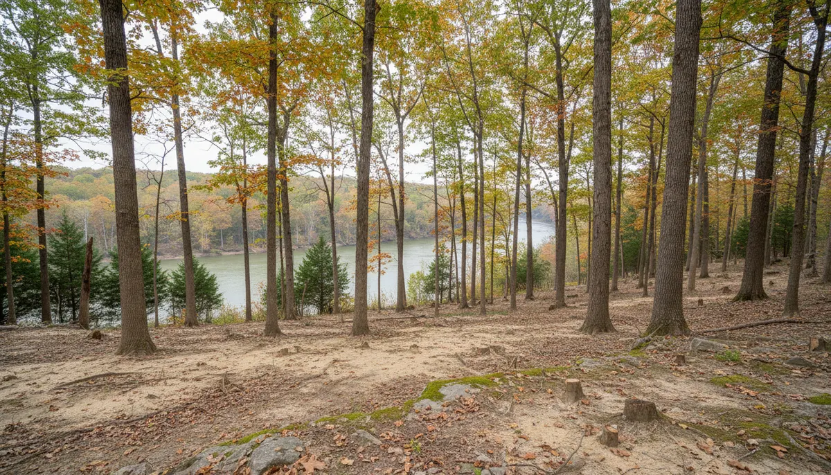
Palmyra is unincorporated Montgomery County, a river settlement on SR 149 southwest of Clarksville inside ZIP 37142, laid out by Morgan Brown and established by act of the legislature in 1796. It became a port of entry the following year and was, by one account, the only port of entry in the west until Cincinnati was granted one two years later. The post office closed around 2010. What is left is Cumberland River frontage, farm ground and wooded ridge in private hands, and almost none of it is the kind of parcel where clearing everything is the right answer.
Selective clearing is the scope that fits that ground. It takes the understory, the scrub, the invasive tangle and specific unwanted stems, and it leaves the mature canopy standing. On river frontage that is usually the only defensible option, because the trees holding a bank are the ones you would otherwise be paying to replace. Clarksville Elite Land Clearing works these parcels stem by stem rather than by area, marking what stays before deciding what goes. Where the brief turns out to be a full removal after all, clearing and grubbing is the different job and it carries a different permit exposure.
What Selective Clearing Has to Work Around in Palmyra
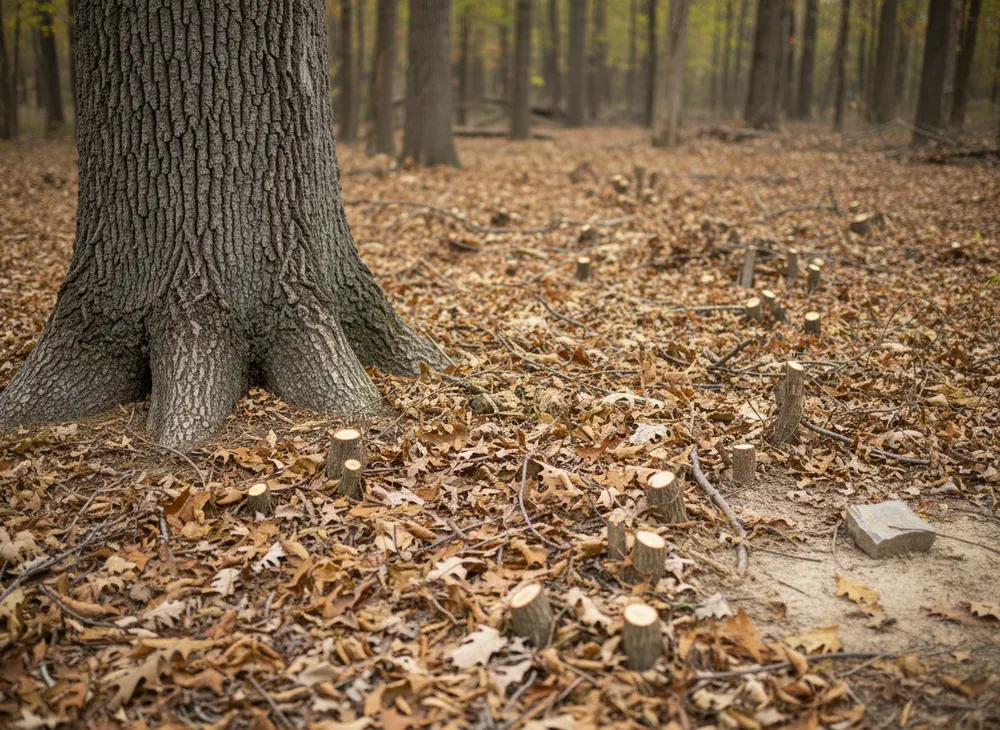
Three constraints shape a retained-canopy job here: the river edge, the species mix standing on the parcel, and the root systems you cannot see.
River frontage and the buffer that comes with it
The Tennessee construction general permit requires a 30-foot natural water quality riparian buffer to be preserved between a waterbody and the disturbed area to the maximum extent practicable, with the minimum acceptable width stated as more than 15 feet at any measured location. On Cumberland frontage that buffer is not an obstacle to selective clearing, it is an argument for it, because retaining canopy inside the buffer strip is exactly what the requirement is asking for. The practical work is to thin the understory inside the strip without stripping ground cover or running a machine across the bank face.
What is standing, and what is worth keeping
Oak and hickory make up 69.7 percent of Tennessee forest land, and by volume the leaders are yellow-poplar at 11.6 percent, white oak at 9.2 percent and chestnut oak at 8.2 percent. By stem count the picture inverts to red maple at 9.6 percent, yellow-poplar at 6.9 percent and sweetgum at 5.6 percent, which is a useful way to describe a selective job: the volume species are usually the ones staying, and the stem count species are usually the ones going. The soil series description for this upland country lists a native mix of oaks, hickory, maple, ash, elm, hackberry and poplar, and 83 percent of Tennessee forest land is privately owned, so the decision on every stem belongs to a landowner rather than an agency.
Root zones and the ground you drive on
The Montgomery County Zoning Resolution defines Critical Root Zone and Drip Line in its landscape, buffering and screening chapter, which is the vocabulary that matters when trees are being kept. A retained tree is lost through what happens under it, not to it: compaction inside the drip line, root severance on a trench line, or grade change over the root plate. Dickson soil, the state soil, carries a fragipan that perches water above it after rain, and compacting a wet silt loam over a root zone is the fastest way to kill a tree you paid to keep. That is why machine choice and access route are decided before the first cut on a selective job.
Selective Clearing Rules and Permits in Palmyra, TN
Palmyra is unincorporated, so the county rather than any city is the jurisdiction, and the office a landowner deals with is a county office. Facts here were checked on 30 July 2026.
The county counter, and what the acreage actually counts
Soil disturbance greater than one acre in Montgomery County follows the county Stormwater Management Regulations, Resolution #13-2-2, alongside TDEC requirements, with Grading, Drainage and Erosion Control plans submitted before any earth disturbing activity begins and the Building and Codes Department as the issuing office. Fees on a non-subdivision project run at $65 per acre for the grading permit, $50 per acre for plan review and a $10 archives charge. The number that governs is disturbed area, not cleared area, which is where selective clearing genuinely differs: a job that removes understory without stripping soil across the parcel can sit below the threshold that a full clear on the same acreage would cross. The county publishes no threshold under one acre, so we confirm the position for your parcel instead of assuming an exemption.
Tennessee does not gate tree removal, it gates stormwater
There is no statewide Tennessee permit for removing trees on private property. The county Zoning Resolution chapter that touches vegetation is a landscape, buffering and screening standard attached to development approval rather than a standalone tree ordinance, and its buffer yard widths and planting rates were not verified for this page, so no figure for them is quoted here. The honest summary is that what actually gates clearing in unincorporated Montgomery County is stormwater. Any contractor telling you that keeping the canopy or mulching in place removes a permit requirement is describing something the acreage rules do not say.
The river, the locates and the burn window
Work that alters a stream, river or wetland requires a TDEC Aquatic Resource Alteration Permit or a Section 401 water quality certification, under the Tennessee Water Quality Control Act and Section 404 of the Clean Water Act. Triggering activities include bank sloping and stabilisation, excavation, channel relocation, filling a wetland, and road and utility crossings. The fee is $50 for a personal residence or family farm, general permits typically take three to four weeks and individual permits must be processed within 90 days. Below that, Tennessee 811 requires at least three working days notice under TCA 65-31-101 with a 24-inch tolerance zone and a ticket valid 15 calendar days, and a Tennessee Division of Forestry permit is required for pile burning from 15 October through 15 May.
Sources for the requirements above:
- Montgomery County Chapter 8 County General SWPPP, Resolution 13-2-2 and the one-acre trigger (https://montgomerytn.gov/storage/departments/stormwater/SWMM%20Chapter%208%20County%20General%20SWPPP.pdf)
- Montgomery County Land Disturbance Permit Application and fee schedule (https://montgomerytn.gov/storage/departments/stormwater/Land_Disturbance_Permit_Application.pdf)
- Montgomery County Zoning Resolution, landscape and buffering chapter defining Critical Root Zone (https://www.cmcrpc.com/wp-content/uploads/2024/01/County-Zoning-Resolution-February-2024.pdf)
- TDEC Aquatic Resource Alteration Permit, triggering activities, fees and processing times (https://www.tn.gov/environment/permits/water/aquatic-resource-alteration-permit--arap-.html)
- Tennessee CGP TNR100000, riparian buffer and stabilisation requirements (https://tnepsc.org/2021_CGPpdfs/Permit.pdf)
Areas We Serve Around Palmyra
SR 149 is the spine of this part of southwest Montgomery County and it is how most of the work here is reached. ZIP 37142 covers river frontage, bottomland field and the wooded ridges behind it, and the parcels are generally long and deep rather than square, which matters because a selective job is priced by how far a machine has to travel between the stems that are coming out.
The folk-art statues carved by Enoch Tanner Wickham are the landmark people navigate by, and the 1796 town plat is a reminder that this ground has been in use for a very long time. Old use leaves traces that affect clearing: farm roads that have closed over, occasional buried material near old homestead sites, and boundaries that have thickened until reopening them is fence line work rather than clearing. We walk for those before quoting rather than finding them with a machine.
The retained-canopy brief varies by why the ground is being opened. Frontage cleared for a view is a different specification from understory taken out to put stock back under trees, and both are different from thinning ahead of a build. We write which one it is into the quote, mark the stems on the ground with you, and leave the marking in place so nothing is decided by a machine operator working from memory. Downstream, the same river conditions run into the Stewart County ground at Cumberland City, where storm work rather than thinning is usually the reason we are called.
Land Clearing Services Available in Palmyra
Four scopes that suit parcels where not everything is coming out.
Selective Clearing
Stem by stem removal with the mature canopy retained. Marked on the ground before work starts, with access routes chosen to keep tracks off root zones and off the bank face.
Forestry Mulching
One machine grinding understory and small stems in place, leaving the material as a mulch layer instead of a pile. It holds soil on sloping ground and avoids a burn decision, but it does not take out roots.
Tree Removal
For individual stems that have to go: dead, leaning, split, or simply in the wrong place. Sectional takedowns where a felling cut would land in something that is staying.
Erosion Control
Silt fence, check dams and stabilisation on frontage and slopes, sized to the buffer requirement rather than to whatever is on the truck.
How We Work in Palmyra
-
Mark what stays first
A selective job is defined by the retained stems, not the removed ones. We mark those with you on the ground and photograph the marking before any machine is unloaded.
-
Route the machine around root zones
Access lanes are chosen to stay outside drip lines where possible and to avoid repeated passes over saturated fragipan ground, because compaction is what kills retained trees.
-
Check the water line before the work line
Riparian buffer measured, any alteration to a watercourse identified and the permit path named, and the county position on disturbed acreage confirmed before a date is held.
Nearby Communities We Serve
Stump grinding around Woodlawn is the unincorporated US 79 corridor north of here, under the same Montgomery County permit requirements.
Gravel drives at Cunningham covers the SR 13 and SR 48 crossroads southeast of here, where long private access runs are the recurring job.
Commercial clearing near Southside is the head service across on the US 48 and 13 corridor in the southeast corner of the county.
Book a Site Walk on Your Acreage
Send the parcel details and we will walk the ground, measure the disturbed area, check the stormwater threshold and put a written scope in front of you before any machine is booked.