Fence Line Clearing in Pembroke, KY
Boundary and cross-fence corridors cut clean on Christian County farm ground, wide enough to work the fence from both sides and narrow enough to keep the trees you wanted.
Get a Free Land Clearing Quote in Clarksville
Tell us the acreage, the road it fronts and what the ground has to do afterwards. Form requests are answered the same working day, and every quote follows a site walk.
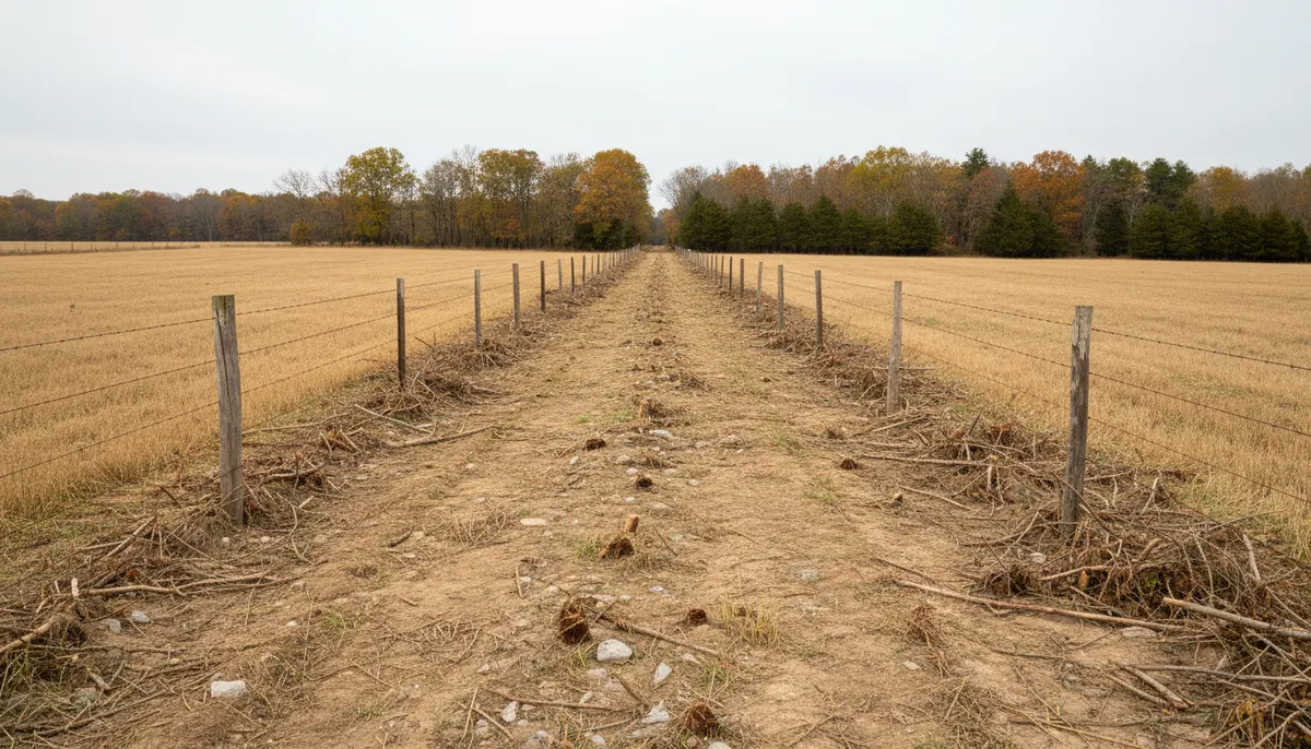
Pembroke covers 1.1 square miles of Christian County, Kentucky, on US 41 about nine miles south of Hopkinsville and fourteen miles north of the Tennessee state line, settled in 1836 and incorporated in 1869, and it sits inside the Clarksville TN-KY metropolitan area despite being in a different state from the city that names it. The ground around it is open farmland, which means the working boundaries here are fences rather than walls, and a fence on Pennyroyal farmland is a line that vegetation will erase if nothing keeps cutting it.
Clarksville Elite Land Clearing cuts and maintains fence lines through this part of Christian County. Corridor work is measured by the run and the width rather than by the acre, because a mile of narrow cross-fence and a mile of overgrown boundary hedgerow are different jobs on the same farm. Where a boundary has closed so far that the fence itself is inside standing timber, the first pass is closer to a mulching job than a trim, and where an owner wants a wider corridor for utilities or access it becomes right of way work priced the same way.
Why Pembroke Fence Lines Close Up
The soil series that carries this ground is named after this place, and it explains most of the regrowth story.
Pembroke soil, and what it grew before it was farmed
The Pembroke series is the classic Pennyroyal upland soil, formed in a thin silty mantle of loess over older alluvium or limestone residuum. It is well drained with low runoff, moderate to moderately slow permeability and a solum from 60 to more than 120 inches, on slopes commonly 0 to 2 percent and ranging to about 12. The official description records the native vegetation as mixed hardwood forest of oaks, hickory, maple, ash, elm, hackberry and poplar, and notes that nearly all of it has been cleared. Deep, well drained ground that grew hardwood once will grow it again, and on a fence line the seed source is standing in the hedgerow you are trying to cut.
Sinkhole plain under the posts
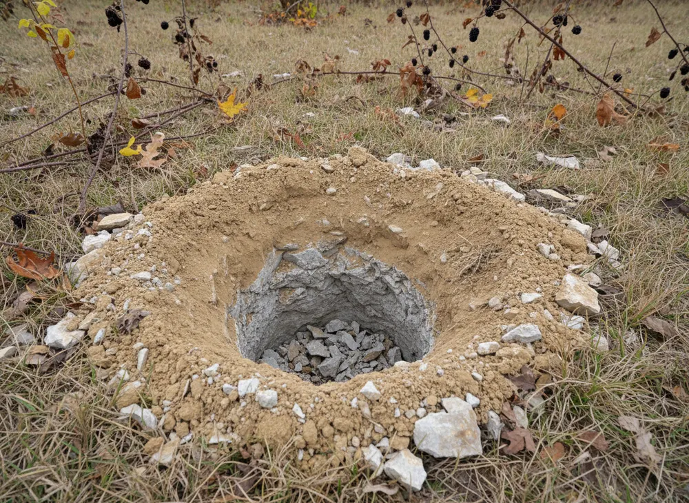
Pembroke sits on the Pennyroyal Plateau, which the USGS describes as a sinkhole plain with a high density of sinkholes and related karst features including deep vertical shafts and blind valleys. On fence work that has two consequences. Ground that looks solid along a straight run is not guaranteed to be solid under a tracked machine, so a new corridor is walked before it is driven. And post holes on karst can find rock or void within the first few feet, which changes the setting method and is far better discovered at the walk-over than with an auger and a crew standing by.
Flat runs, long lines and equipment access
Slopes of 0 to 2 percent across most of this ground mean fence lines run long and straight, which is good for production rate and bad for maintenance intervals, because a long line has more hedgerow feeding it. The practical variables are corridor width, gate width and the state of the field entrance rather than terrain. A line entered from both ends and cut in one direction prices differently from one with a single entrance and a turnaround problem, and an entrance that carries a machine in September will not always carry it in March.
What Governs Fence Line Work in Pembroke, KY
Pembroke is in Kentucky. Everything in this section follows from that, and it is the fact a contractor working out of Clarksville is most likely to get wrong on a Christian County job. Checked 30 July 2026.
Nothing from the Tennessee side reaches this parcel
The Tennessee construction stormwater general permit, the Tennessee Division of Forestry burn season, the Tennessee one-call notice period, the Tennessee contractor licence threshold and the Montgomery County stormwater resolution and fee schedule are all instruments of a state and a county that stop at a line fourteen miles south of here. None of them govern a fence line in Christian County. Kentucky runs its own environmental agency, its own division of forestry, its own one-call notification centre and its own county government, and Christian County sets local requirements without reference to any Tennessee county. A quote that carries a Tennessee acre fee or a Tennessee burn window onto this ground is simply wrong, and we do not write one.
The categories that do apply, and who issues them
Three approvals are usually in play on corridor work here. Construction stormwater coverage, administered by the Kentucky state environmental agency, applies once enough ground is stripped and left exposed. An underground utility locate placed through the Kentucky one-call centre has to be on the ground before any post hole, anchor or blade goes below grade, and on a fence line that is not optional, it is the whole risk. And the corridor itself can carry a Christian County or City of Pembroke approval where it touches a public road right of way or an entrance. The acreage triggers, notice periods and fees attached to each of those are Kentucky and Christian County numbers, they are not published here because we have not verified them for this page, and we confirm all three against the specific parcel before a machine is booked.
The federal layer, which is the same on both sides of the line
A fence line that crosses a stream, a wet-weather ditch or a wetland raises a Clean Water Act Section 404 question regardless of which state the parcel is in, because that authority is federal. The paired water quality certification under 33 USC 1341 is issued by the Kentucky agency on this side of the line rather than by Tennessee. Boundary fences follow property lines rather than drainage, so they cross water more often than any other corridor type, which is why the full run gets walked before pricing instead of the two ends and a map.
Sources for the requirements above:
- TDEC construction stormwater permit, cited to mark the Tennessee regime that stops at the state line (https://www.tn.gov/environment/permit-permits/water-permits1/npdes-permits1/npdes-stormwater-permitting-program/npdes-stormwater-construction-permit.html)
- Tennessee Division of Forestry burn permits, cited for the same boundary reason only (https://www.tn.gov/tnwildlandfire/prevention/safe-debris-burning/permits.html)
- Tennessee 811 law, cited to show Kentucky runs a separate one-call centre (https://www.tenn811.com/law)
- State and federal wetland regulation, for the Section 404 and 33 USC 1341 framing (https://www.tn.gov/environment/program-areas/wr-water-resources/watershed-stewardship/wetlands/state-and-federal-wetland-regulations.html)
- USDA official soil series description for the Pembroke series (https://soilseries.sc.egov.usda.gov/OSD_Docs/P/PEMBROKE.html)
- USGS on Pennyroyal Plateau karst and sinkhole plain features (https://pubs.usgs.gov/wri/wri974097/text/karst.html)
Where We Cut Fence Lines Around Pembroke
The corporate limit here is 1.1 square miles, which is small enough that almost all the fence work we are asked for sits outside it on Christian County farm ground. US 41 is the road that organises the area, running north nine miles to Hopkinsville and south fourteen miles to the Tennessee line, and the farms feeding off it are worked in blocks large enough that a single owner can have several miles of boundary and cross-fence between them.
Inside the town the older blocks are tight, with mature trees close to overhead service and short setbacks, and corridor work there is a small-machine or a hand-and-chipper job rather than a mulcher job. We say which one it is before quoting rather than arriving with the wrong machine. Out on the county roads the constraint reverses: room to work, long runs, and access limited by a gate width and a soft field entrance.
The state line fourteen miles south is the most important thing on a quote here, and not because of distance. A landowner with ground on both sides of it has two permitting regimes, two one-call centres and two burn calendars on what is functionally one farm. We split those jobs at the line for permitting purposes and say so on the quote. Where an owner mainly needs growth knocked back rather than a corridor reopened, bush hogging is the cheaper and honest answer.
North on US 41 the parcels get larger toward Hopkinsville, which is where acreage pricing starts to beat corridor pricing, and that ground is covered under forestry mulching around Hopkinsville.
Land Clearing Services Available in Pembroke
Four scopes that come up most often on Christian County farms.
Fence Line Clearing
Boundary and cross-fence corridors cut to a stated width and height, on a first pass or a maintenance cycle, with the line agreed on the ground before cutting.
Brush Clearing
Briar, multi-stem scrub and volunteer growth taken off the ground beside a fence without disturbing the soil profile the pasture depends on.
Forestry Mulching
Where a boundary has closed into a block of standing brush, one machine grinds it in place and leaves the material as mulch. No pile and no burn decision.
Bush Hogging
Keeping a reopened corridor open on a cycle, which is always cheaper than letting it close and paying for the first pass a second time.
How We Work in Pembroke
-
Agree the line on the ground
A boundary fence is a legal line as well as a working one. We walk it with you and agree what is being cut rather than reading a corridor off an aerial photograph.
-
Confirm the Kentucky requirements
Kentucky stormwater coverage where enough ground is stripped, the Kentucky one-call locate before any post hole, and any Christian County or city approval attached to a road frontage.
-
Cut, then set an interval
The first pass on a closed line is the expensive one. It finishes with a realistic interval for the next cut based on what regrew and how fast, not a number picked in advance.
Nearby Communities We Serve
Forestry mulching around Hopkinsville is nine miles north on US 41, the Christian County seat, where parcels get big enough for acreage pricing to win.
Right of way clearing in Guthrie covers the corridor and rail-side work east of here in Todd County, on the same Pennyroyal ground and under the same Kentucky rules.
Site preparation in Oak Grove is the build-pad work southwest along the state line beside Fort Campbell, still Kentucky and still outside the Tennessee regime.
Bush hogging at Adams is the first Tennessee stop south on US 41 through Guthrie, in Robertson County, where an entirely different rulebook applies.
Book a Site Walk on Your Acreage
Send the parcel details and we will walk the ground, measure the disturbed area, check the stormwater threshold and put a written scope in front of you before any machine is booked.